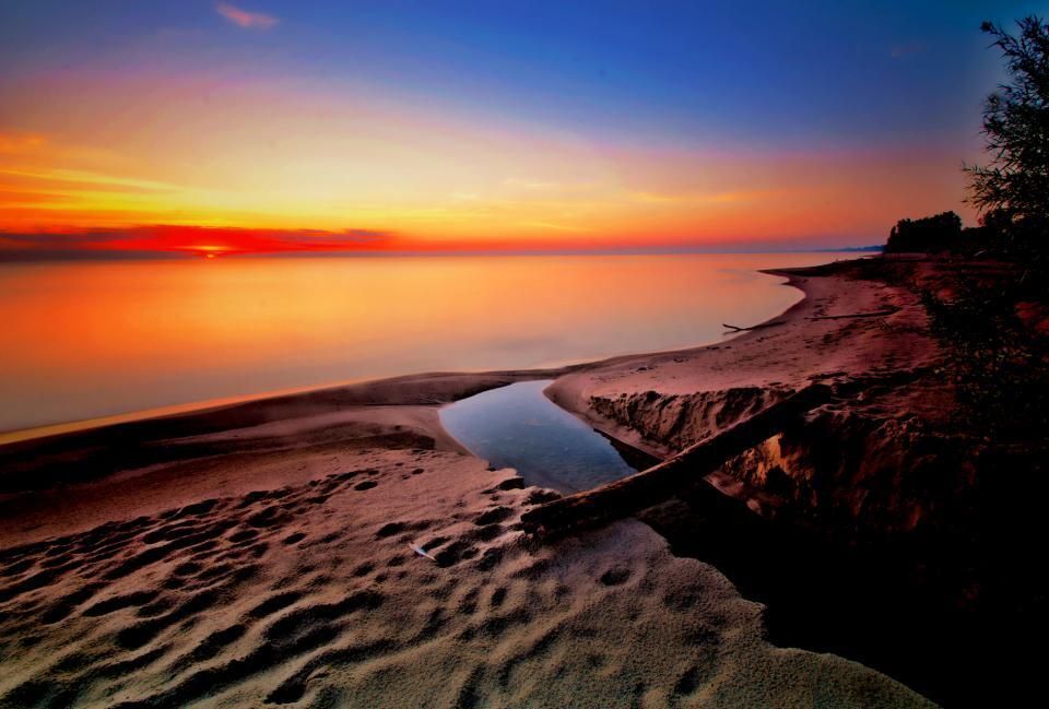
The Maumee River is the largest Great Lakes watershed, draining all or part of 17 Ohio counties, two Michigan counties, and five Indiana counties into Maumee Bay and then to Lake Erie just east of Toledo, Ohio. The total watershed covers 8,316 square miles. The mainstem of the Maumee River is approximately 136 miles in total length with 25 miles in Indiana and 111 miles in Ohio. It begins in Fort Wayne, Indiana at the confluence of the St. Joseph and St. Mary’s rivers. The headwaters are the St. Joes, the St. Marys and the Maumee in Fort Wayne, Indiana. The Maumee River has several major tributaries: the Tiffin, Auglaize, and Blanchard rivers. The highest elevations of 1,100 feet above mean sea level occur in the Michigan portion of the watershed. At the Ohio/Indiana border, the elevation of the Maumee River is 707 feet above mean sea level. At Maumee Bay the river is 573 feet above mean sea level, dropping an average of 1.3 feet per mile. The steepest section is between Waterville, Ohio and Maumee, Ohio at 5 feet per mile. Below Rossford, Ohio the Maumee is about the same elevation as Maumee Bay/Lake Erie. Daily average discharge ranges from a high of 94,000 cubic feet per second (CFS) to a low of 32 cfs, and contributes about 50 percent of the total tributary discharge into Lake Erie, exclusive of the Detroit River.
A large part of the basin south of the river near Toledo is in the area formerly covered by the Great Black Swamp. The Great Black Swamp was covered with wet forests of hardwood, shallow lakes, and wet prairies. In 1859 a law providing for public ditches was passed. This law resulted in the entire Black Swamp being drained through extensive ditch systems, and more people began to settle there. By 1900, most of the Great Black Swamp was gone. It has been estimated that there are three miles of man-made ditches to every mile of natural stream.
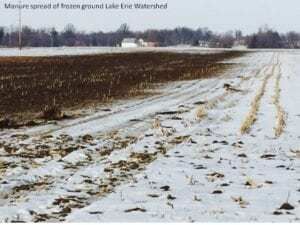
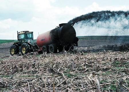
At present over 70% of the watershed is recognized as agricultural use. Drainage ditches make productive farming possible, but many do not provide fish or wildlife habitat. Ditches that lack buffer areas and are farmed up to the ditch bank provide a route for nutrients and sediment runoff to the river.
Despite draining and channelizing streams, the Swamp is still there. It remains subject to flooding. Black Swamp streams could be good candidates for restoration and reestablishment of habitat by expanding floodplains and wetlands. Habitat areas on these headwater streams support the base of the food chain which ultimately feeds Lake Erie.
The Oak Openings Region is in the Maumee River Basin. The Oak Openings Region is a 130 square mile area supporting globally rare oak savanna and wet prairie habitats. It is home to more rare species of plants and animals than any other area of Ohio. Its trees, plants, sandy soils, wet prairies, and floodplains benefit the region by acting as natural filters for our air and water. It is widely agreed from government agencies to citizen groups that the Oak Openings Region with its wet prairies and savannas, together with the connecting corridors along the Maumee River, Swan Creek, and Ottawa River should be given the priority for preservation. By maintaining the natural character of these areas, they will continue to benefit humans and wildlife long into the future.
In July 1974 the Maumee River was designated an Ohio State Scenic River from the Ohio/Indiana state line to Defiance, Ohio (43 river miles) and a State Recreational River from that point downstream to the Maumee/Perrysburg Bridge (53 river miles). These two designated areas have special restrictions on development and permitted discharges.
In 1985 the International Joint Commission designated the lower Maumee River as an Area Of Concern (AOC). Heavy metals and organic chemical sediment contamination were a major reason along with a noted concern that the Maumee River contributes the largest tributary load of suspended sediments and phosphorus into Lake Erie. In 1987 the Maumee Remedial Action Plan (Maumee RAP) was formed under the management of the Toledo Metropolitan Area Council of Governments (TMACOG) with ex-officio leadership provided by a full-time Ohio EPA coordinator. It has grown and changed over the years, but has always been a public-private partnership working to delist the Maumee as an AOC.
Initially, only the lower 22.8 miles of the Maumee River to Maumee Bay/Lake Erie where included in the AOC. This area included direct drainage into the waters that are within Lucas, and Wood counties. The AOC was subsequently expanded to hwat riover(s) in Ottawa county farther east along the lake but not farther upstream along the Maumee. Therefore, the majority of the river and its contributing watershed are are not included in the MaumeeRAP because it is outside of the AOC.
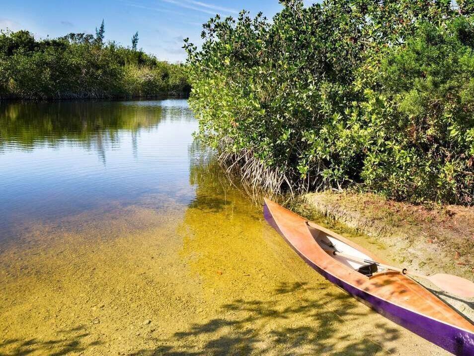
In 1815 a writing about the Maumee River describes the fish as “so numerous are they at this place that a spear may be thrown at random, and will rarely miss killing one! … Some days there were not less than 1,000 taken by hook from Swan Creek (in downtown Toledo), and the shoals of the bay swarmed with ducks, and geese. The woods were filled with deer, elk and wild turkeys.” While that is not true today, the Maumee River is still a treat to the eyes in many areas. Whether driving along the river, canoeing on it or walking the old towpath trails one can sometimes travel for miles without significant signs of civilization. Near the Maumee/Perrysburg bridge only 5 to 10 miles from downtown Toledo, the river is still several hundred yards wide but a limestone ledge renders it too shallow for power boats for most of the year. These same shallows are the sight of Spring spawning runs of Walleye and White Bass that draw thousands of anglers from all around the region. Other signs of river health include the return of Bald Eagles, Great Blue Heron, White Heron, Egrets, Osprey and even an occasional migratory Whistling Swan.Currently the Maumee River watershed is targeted for the massive amounts of sediments – over 50% of Lake Erie’s sediment load – that flow into Lake Erie. In addition the Maumee watershed provides over 40% of the phosphorous load to Lake Erie. which Heidelberg University states is predominately from agriculture(which includes manure).